I met up with Art in East Hampton about 5:15 to drop my car at the southern end of the trail. I literally met Art for the first time at this point as he had recently learned of the day's excursion through a trail running club I just joined, The Shenipsit Striders. After a brief discussion of logistics, plans, and expectations Art was eager to join and we welcomed him in. We picked up Scott at the Bolton Notch area parking lot of the rail trail, grabbed Mark in Tolland, and headed to the northern end of the trail on County Rd.
With hydration packs loaded with fuel we started our journey shortly after sunrise. After a couple miles we found ourselves in familiar territory of Soapstone Mountain. Scott, Mark and I have done a fair amount of trail running at Soapstone Mountain, Shenipsit Lake area, Belding Wildlife area, the rail trail, and Case and Birch Mountains. We moved well early on and I was pleasantly surprised to learn of some of the pieces of the trail that connect these unique and special places.


 Mark, Bruce, and Art
 Heading Through Valley Falls
We could see and hear the impact of the high winds as trees, limbs, and branches were strewn thought the trail. However, we were fortunate to enjoy comfortable temperatures and sunshine on our journey.
 The branch that missed Scott by a nanosecond
After heading through some steep and rocky terrain at Soapstone, flat and straight at Shenipsit Lake, comfortable pines at Belding, and the rail trail we arrived at Scott's car which doubled as our solo aid station. After a brief stop to refill hydration packs, enjoy some oranges courtesy of Scott, and some other goodies, we said our goodbyes to Scott and continued on our way.
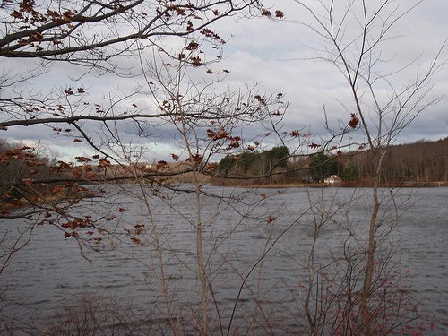
 Scott and Bruce
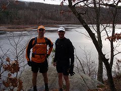 Art and Mark and Bolton Notch pond.
Our pace slowed as we continued on the ascent up to Birch and Case Mountains. Case Mountain was probably the area we experienced the most people enjoying the trail, which is no surprise as it's an absolutely beautiful track out and into the Meshomasic State Forest.
Throughout the day our only issues with navigation seemed to occur heading through the roads that connected the woods. Mark's internal compass proved trustworthy, but relied on his detailed maps when needed. We ended up off course a few times, but were able to get back on track without much of an issue.

Feeling the fatigue of the day, we were encouraged as we reached Rte 2, a landmark that we were looking forward to getting behind us. One of the busiest travel and traffic weekends of the year was kind to us as we had an opportunity to cross both lanes without much of a wait. Fortunately our crossing window was wide open as Art's leg cramped up as we made our way over the pavement.
 Successful crossing of Rte 2
 Falls in Easthampton
The sun made it's way lower as we made our way through the "Mesh". We dodged our way through and around the standing water on the jeep roads of the next few miles. We continued into East Hampton and saw the sunset, climbed our way up over a ridge and experienced another sunset. As it grew dark we neared the end and were treated with an impressive overlook of Great Hill Pond and the surrounding area.


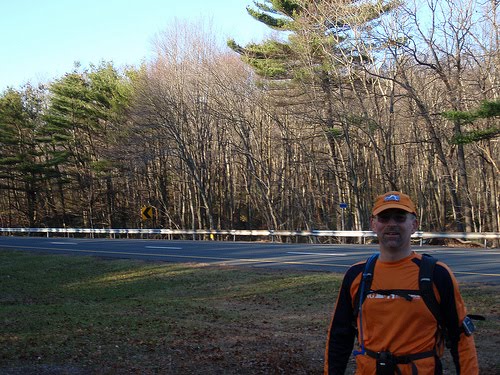
 Self photo at completion
Started just after sunrise, finished just after sunset, total of 46 miles. It was great to experience the Shenipsit trail from end to end.

5 comments:
i am a resident of Stafford and was intrigued by your run. i am wondering if you carried a gps and can upload the .gpx file or post it on the striders website or facebook page. loks like a great run that we may take a shot at in the spring. congrats on finishing uninjured
also wondering if you could give suggestions on maps to use??
thanks
An attempt was made to record the course on GPS but lost connection too many times and it didn't work out. I used the map here as for a general overview http://www.ctxguide.com/ctxguide_234.htm. Mark carried a more detailed map from a CT trail map book.
An attempt was made to record the course on GPS but we lost connection too often so didnt work out. I used this map for a general overview http://www.ctxguide.com/ctxguide_234.htm
Mark carried detailed maps from his CT trail map book.
Awesome! I'm doing it. Trail running shoes or road shoes?
Post a Comment